The two London walks featured here make use of Charles Booth’s famous poverty maps (1898-9) which, thanks to the London School of Economics, can be viewed and compared to a contemporary street map. Directions and discussion of the various places to look out for can also be accessed alongside these. You can walk them for real or virtually.
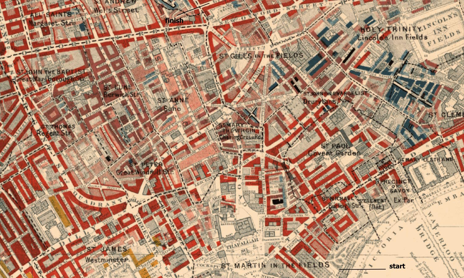
Exploring informal education. Walking in central London we can find many places associated with key figures and moments in the making of informal education. Explore them through a virtual (or real) walk that starts by the River Thames next to Charing Cross Station and makes its way northwards via The Strand, Covent Garden, Trafalgar Square, Soho and ends close to Tottenham Court Road Underground Station and Oxford Street. [updated October 2025]. Click to download the pdf version.
Exploring social action. A walk exploring the nature of social action – and the role of settlements, missions and community organizations. It also reflects on some of the key people involved. The walk starts close to Tower Bridge and ends in Rotherhithe. [updated October 2025]. Click to download the pdf version.
Both walks are available online via infed.org.
Exploring South Ronaldsay
exploringsouthronaldsay.net provides a picture of the history and daily life of this Orkney island, some 700 miles north of London. It is where I live. You don’t have to go far here to find fascinating places to visit and things to do. The site lists places of historic interest and walks that take in some key features of South Ronaldsay. It includes material on churches and chapels, the history of local schooling, and archaeological sites.
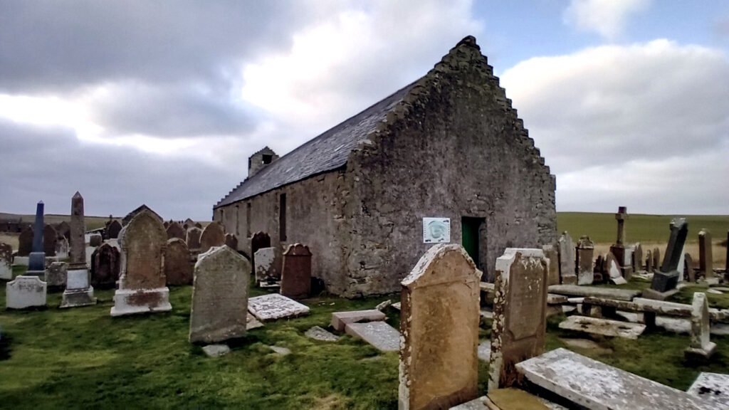
Also included are three walks developed by islanders (and in particular, Sheena Graham-George). One is in St Margaret’s Hope (see below), another is in Burwick (you can see a map of the walk on the wall of the kirk above). The third South Ronaldsay listening walk, developed by Sheena, is around St. Peter’s Kirk, Eastside. Each has stops complete with recordings of islanders talking about local life and experiences. You just click to listen – wherever you are.

A further excursion takes in all 19 of the listed buildings on Burray and South Ronaldsay: Exploring listed buildings from north to south. There are some fascinating places involved, one of which is the Fourth Churchill Barrier (built during the Second World War), which joins the two islands.